I live on the USA West Coast and know a thing or two about wildfires. I have a hard time getting insurance on my home since it is considered to be in a high risk “brush area”. A year ago, a 540 acre wildfire came within 3 miles of my home. And, every year in California there are wildfires which need time, manpower, muscle, technology, resources and money to fight.
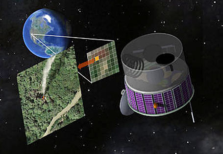
So, that’s why I was happy to hear that researchers at the University of California at Berkeley and from the Lawrence Berkeley National Laboratory, have come up with a unique satellite design, called FUEGO (Fire Urgency Estimator in Geosynchronous Orbit).
According to Boise Weekly, “…they’ve designed such a satellite, with state-of-the-art sensors which would snap pictures of the ground every few seconds in search of hot spots that could be newly ignited wildfires. The researchers said firefighting resources could then be directed to the hotspots of preventing the fires from growing out of control.”
The early detection and immediate feedback from the FUEGO satellite will save time, money, land and lives. No word yet as to how campers would be affected. But, if successful, trees and homes will also be saved and less carbon will be spewed into the air we breathe.
Photo Credit: R. E. Lafever, Lawrence Berkeley National Laboratory
Sorry, the comment form is closed at this time.